open source
God's Eye View: A Spy Satellite in Your Browser, With Real Data
A free open-source globe that tracks live aircraft, satellites, ships, fires and undersea cables on real data from OpenSky, CelesTrak and USGS. The no-code setup that takes two clicks, and ten things worth asking it once it is running.
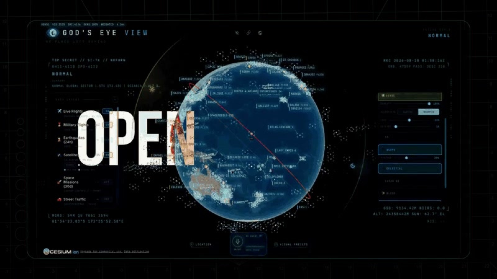
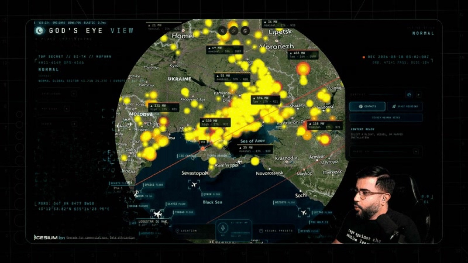
God's Eye View describes itself as "a spy satellite simulator in your browser, except the data is real". It's a free, MIT-licensed 3D globe that pulls live aircraft, satellites, ships, earthquakes, fires and weather from public feeds, it runs without a single line of code, and it's on about 42,000 stars.
I found it through the demo footage and assumed it was a rendering. It isn't. The planes on that globe are the planes in the sky right now.
What is it actually showing?
Real feeds, all of them public, which is the whole point and also the slightly unsettling part.
Aircraft come from OpenSky and adsb.lol. Satellites come from CelesTrak, running a catalogue of 838 objects. Vessels come from AISStream. Earthquakes come from USGS. On top of that it carries NASA FIRMS for fires, NOAA for weather and cyclones, transit operator feeds, Radio Browser, and bundled datasets for data centres, dams and submarine cables. Nineteen live layers in total.
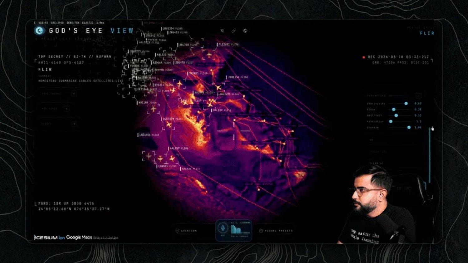
None of this data is secret. It's the same feeds hobbyist flight trackers have used for years. What's different is having all nineteen layers on one photorealistic globe with a sensor view over the top, which is a presentation problem somebody finally solved properly.
Do you need to code to run it?
No, and this is the part worth getting right because the GitHub page can make anything look like a project.
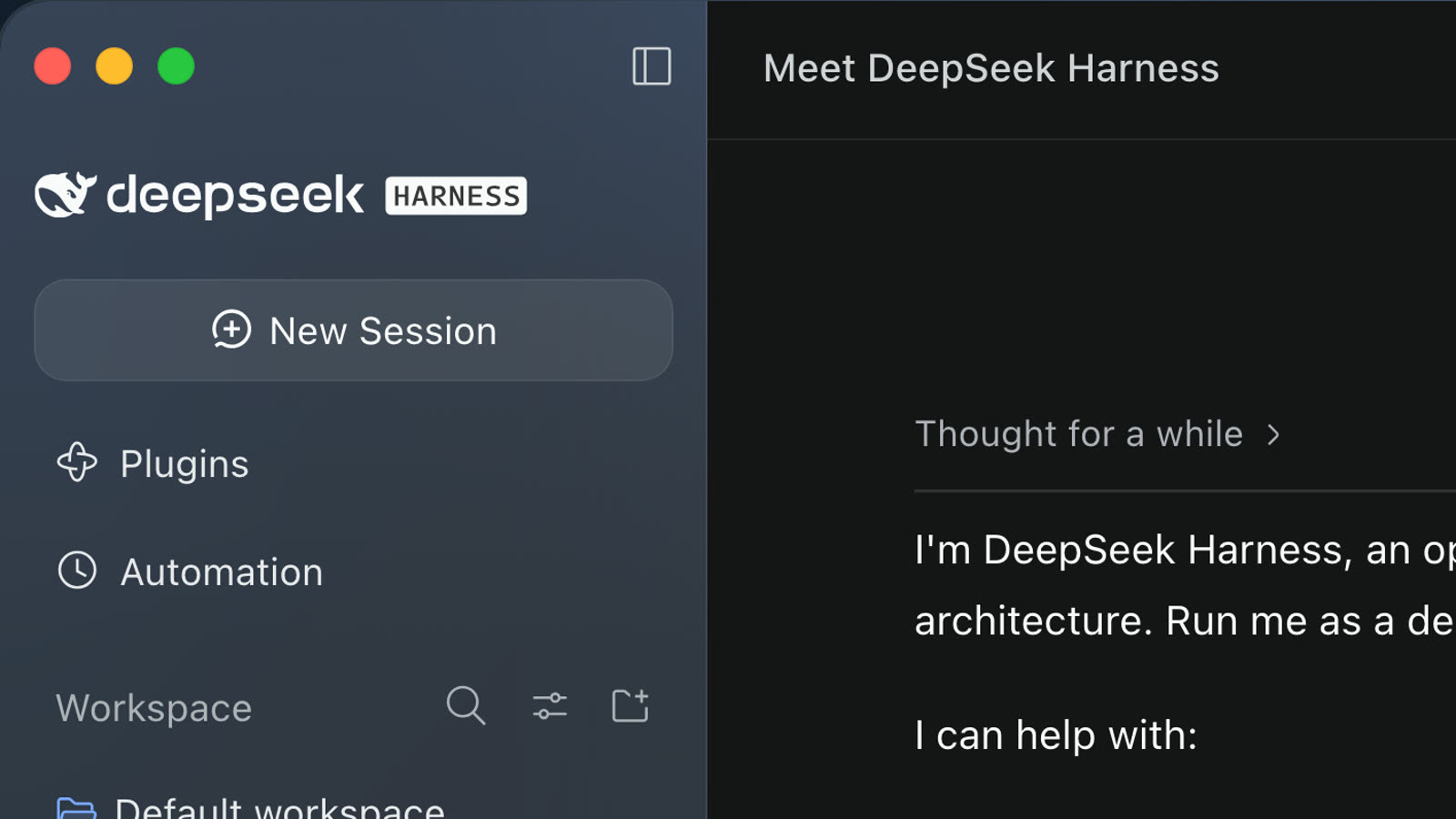
The simple path is Pinokio, a desktop app that installs and runs open-source projects for you. Install Pinokio version 8.2 or later, find God's Eye View in it, click Install, then Start. That's the whole thing.
If you'd rather use a terminal, you'll need Node.js 24 or 26, then it's git clone, npm ci, npm run dev. Same result, more steps.
Either way it runs keyless. It starts on Esri satellite imagery and terrain with no account and no API key, and the keys are optional upgrades you add later through an in-app panel if you want more out of it. I'd run it keyless first. Most people will never need more.
It's maintained by Bilawal Sidhu and Sameh Khamis at Halfpixel, under an MIT licence.
Ten things worth asking it
I promised ten in the video. These are the ones that either teach you something or are just properly good fun, and they're roughly in the order I'd do them.
- Find the plane over your own house. Start there. It stops being a demo the moment the thing on screen is the noise you can hear.
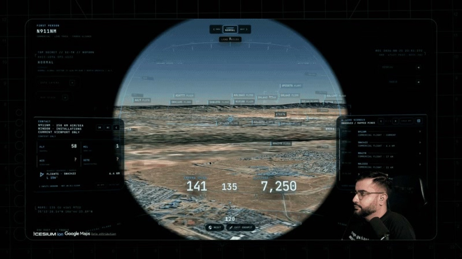
- Drop into cockpit mode on a long-haul flight. It has a real-time cockpit view for a tracked aircraft, which puts you in the seat of something actually flying right now.
- Watch the ISS cross a country. Track it along its real orbital path and follow it over somewhere you know.
- Turn on the submarine cable layer. This is the one that reframes the internet for most people. Nearly all of it is a few dozen cables on a seabed.
- Switch to thermal or night vision. It has GLSL sensor modes, FLIR and NVG, and the same scene under thermal reads completely differently.
- Put the data centre layer on next to the cable layer. You can see why certain countries are where the internet physically lives.
- Watch the fire layer during a fire season. NASA FIRMS data on a globe is a much harder thing to ignore than a news figure.
- Follow a container ship for a leg of its route. AIS data makes supply chains something you can watch rather than read about.
- Check the 250 km contact roster from somewhere remote. Seeing what's actually in the air over the middle of an ocean is its own education.
- Use the scene director to record something. It has a cinematic mode, so the thing you found is also the thing you can show someone.
FAQ
Is God's Eye View's data really live?
Yes. Aircraft come from OpenSky and adsb.lol, satellites from CelesTrak, ships from AISStream and earthquakes from USGS, across nineteen live layers.
Do I need to code to run God's Eye View?
No. Install Pinokio 8.2 or later, find God's Eye View, click Install and then Start. There's a terminal route too if you have Node.js 24 or 26.
Does God's Eye View need API keys?
No. It runs keyless on Esri satellite imagery and terrain. Keys are optional upgrades you can add later in the app.
Is God's Eye View legal to use?
Everything it shows is already public: aircraft transponders broadcast openly, satellite catalogues are published and ships are required to run AIS. The project makes that data easier to see rather than unlocking anything new.
Is any of this a problem?
Worth saying, because "spy satellite" is in the name and people reasonably ask.
Everything here is already public. Aircraft transponders broadcast openly, which is how every flight tracking site works. Satellite catalogues are published. AIS is a maritime safety system that ships are required to run. The project hasn't unlocked anything, it has made what's already open much easier to look at.
Whether that's neutral is a fair question and I don't think it has a clean answer. Aggregation changes things even when every input is public, which is the same argument that comes up about open data generally. I'd just rather people know it exists than not.
The reason I'd point a non-technical person at this one specifically is that it's the rare open-source project where the payoff arrives before any of the work does. Two clicks and you're looking at the real sky. Most things that look this good want a weekend from you first.